.avif)
.avif)

.avif)

.avif)
.avif)
.avif)

.avif)
Thank you! Your submission has been received!
Oops! Something went wrong while submitting the form.
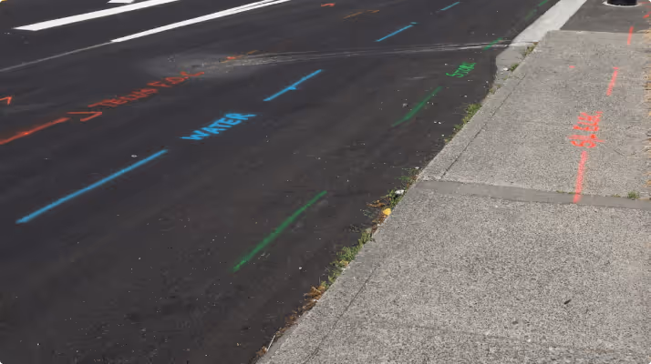
The New Era of Utility Mapping
Damage prevention is a crucial principle in the protection and maintenance of existing utility infrastructure during any form of excavation, from roadworks and new utility construction to civilian digging projects.

Jemmie Wang
February 17, 2026
Industry Insights
Reports & Guides


Our Newsletter
Join 7k infrastructure professionals
Get monthly insights on ways to build smarter, faster and safer with Utility AI.