The Future of Utility Mapping, AI Innovations, and Winning with 4M
Written by
.avif)
Chris Garafola
Published on
January 22, 2025
.avif)

Table of contents
During his military service, 4M Analytics Co-Founder and CEO Itzik Malka was trained to locate and dispose of buried explosives. That experience sparked Malka’s interest in the subsurface, which contains an underground network of man-made infrastructure powering the lives of every American.
Fast-forward to 2019, when Malka started 4M Analytics. Early on, the 4M team connected with Subsurface Utility Engineering (SUE) pioneer Jim Anspach, Affiliate Assistant Professor at Iowa State University Civil Construction and Environmental Engineering, who became a mentor and advisor. With valuable input from industry leaders like Anspach, Malka and the 4M team refined the company’s goal: to build the first Utility AI platform designed to equip civil engineers with instant, reliable utility data and actionable project insights.
4M’s Vision: A Digital Future for Utility Research
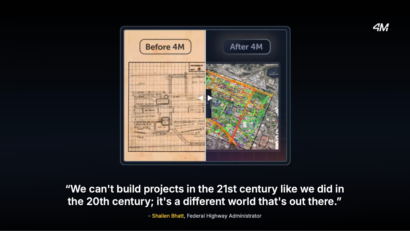
From the beginning, 4M has been on a mission to revolutionize traditional utility research—replacing outdated processes with a single, comprehensive utility map that delivers reliable utility data into the hands of construction designers, owners, and managers instantly.
Today’s civil engineers still rely on slow, outdated manual processes to gather utility data for infrastructure projects. Getting needed utility data can often take weeks or months, and involves tasks such as contacting utility owners, sending follow-ups, calling 8-1-1 One Call, and sending investigators into the field. “It’s manually intensive, expensive, and you have to do it all over again for every project,” says Malka. “We want to reduce the need to send people to the field, especially early on in a project.”
4M set out to design a digital solution that’s easy to navigate and able to tackle the other challenge around traditional utility research—a rising demand and coinciding lack of humans to do the work. “For each of the 42 million projects that go to construction, you have to communicate with 6.3 utility owners on average,” says Malka. “More than half of this space doesn’t get located on time because you don’t have enough people to send out. We can’t keep throwing humans at this challenge—instead, we have to solve the capacity problem through digitization.”
4M cannot replace all field investigation, but instead provide civil engineering firms with a ready-to-use digital map at a fraction of the time and cost they would spend sending humans to the field. “We want our data to become the foundation for everything you do in planning, designing, and executing construction projects,” says Malka. “We can get you the data you need—quickly—to see what you’re up against in a new project.”
How are we doing on fulfilling that goal? Let’s take a quick tour of developments in 2024 and 4M’s roadmap for 2025.
Utility AI Mapping Innovations
In 2024, 4M’s goal was to make reliable utility data available instantly. We did that by introducing the Foundation Utility Data Layer and adding other product features and AI advancements, including:
Rapid Utility Data Enhancement
We’ve enhanced our utility data processes to deliver enriched project data within 1–2 business days. This rapid turnaround reduces risk and helps teams stay on schedule, providing verified and actionable data when it’s needed most.
Advanced AI Object Detection
We identified 555,000 on-surface utility objects this year with 85% accuracy. Using satellite imagery, dashcams, and historical data, we geo-referenced objects like poles, manholes, and valves to ensure confident, data-driven planning.
Generative AI Fusion Engine
This advanced AI engine consolidates utility data from millions of public records into a single, comprehensive map. By synthesizing GIS data, visual objects, and metadata, it delivers reliable, actionable insights validated through advanced algorithms and engineering logic, enabling confident and precise decision-making for every project.
Let’s dive into how 4M’s data creates value throughout the construction project lifecycle—backed by real customer testimonials.
Early Planning and Preliminary Design
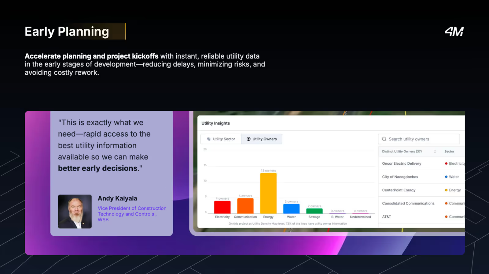
Access to needed data early in the design and planning phase is a powerful way to mitigate risk. “This is exactly what we need—rapid access to the best utility information available so we can make better early decisions,” says Andy Kaiyala, VP Construction Tech and Controls at WSB.
Pursuits and Proposals
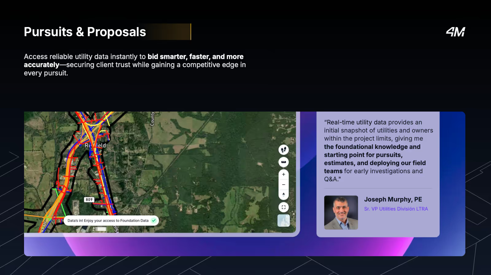
Before pursuing a project and creating a proposal, teams can review 4M utility data to get an instant picture of what they’re up against in the subsurface. “Real-time utility data provides an initial snapshot of utilities and owners within the project limits, giving me the foundational knowledge and starting point for pursuits, estimates, and deploying our field teams for early investigations and Q&A,” says Joseph Murphy, PE, Sr. VP of Utilities Division at Lina T. Ramey & Associates, Inc. (LTRA).
Field Investigation QA/QC
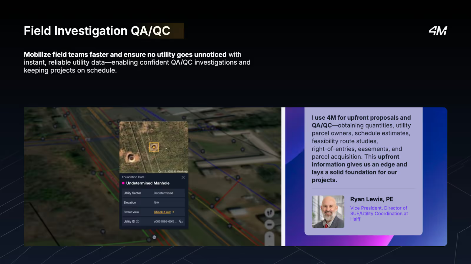
4M data gives organizations what they need to mobilize teams faster and ensure no utility goes unnoticed, enabling confident QA/QC investigations. “I use 4M for upfront proposals and QA/QC—obtaining quantities, utility parcel owners, schedule estimates, feasibility route studies, right-of-entries, easements, and parcel acquisition. This upfront information gives us an edge and lays a solid foundation for our projects,” says Ryan Lewis, PE, VP and Director of SUE/Utility Coordination at Halff.
👉 Read more: Discover How Halff Streamlines Proposals and QA/AC with 4M.
By the end of 2024, Foundation utility data was available on demand for eight U.S. states. In 2025, we plan to expand to 22 mapped states, including Washington, Arizona, Michigan, and Pennsylvania.
Advancing Utility Intelligence in 2025 and Beyond
While there’s tremendous value in the easy-to-use utility AI mapping platform we currently offer, 4M is taking it a step further—to what we call utility intelligence.
The goal is to generate actionable project insights with the foundation of utility data we now have. For example, a new AI-generated utility Lines feature that detects undocumented lines. In addition, we will expand object detection by identifying more utility on surface object asset types, including poles, pedestals, and road marks for utilities, and conflate those with existing streams of utility data. “Everything we’re creating will be complementary,” says Kaustubh Page, Senior Product Director at 4M. “These layers of data will provide better logic for estimating where utility lines are.”
Building on project level utility intelligence, we will also offer portfolio insights, a bird’s-eye view across hundreds of projects in your organization.
Generative AI (GenAI) will play a key role in this journey—acting as a doorway to interact with proprietary utility data and quickly analyze and disseminate information. For example, imagine querying a chatbot to find out how many utilities are inside and outside the Right-of-Way boundaries for your project—and receiving an instant estimation. You can also ask it to identify a utility owner and write a utility coordination email. “This will be a powerful tool because it’s trained on proprietary data,” says Page. “The AI tool understands a lot of context.”
Ready to transform your 2025 project workflows? 4M Analytics helps you plan faster, kick off smoothly, bid smarter, and deliver on time and on budget—all with one easy-to-use platform built to fit your workflow. Book a demo with a 4M mapping expert to learn more.
Recent blog posts

Our Newsletter
Join 7k infrastructure professionals
Get monthly insights on ways to build smarter, faster and safer with Utility AI.
