LTRA drives digital transformation and gains competitive edge with Utility AI Mapping
Written by

Chris Garafola
Published on
October 2, 2024


Table of contents
Customer Profile
LTRA is a professional consulting engineering, surveying, and subsurface utility engineering firm established in 1998 in Dallas, Texas. The firm maintains a strong reputation, broad-based technical expertise, and a sincere commitment to client service. Among other initiatives, LTRA works on infrastructure and construction projects across Texas.
Project Background
Currently, LTRA is working with the Texas Department of Transportation (TxDOT) on a project that includes rebuilding and widening a 38-mile stretch of U.S. Highway 83. The pre-planning stage of a construction project like this one traditionally includes extensive research and detailed Subsurface Utility Engineering (SUE) surveys to pinpoint the location of existing utilities. Gathering all the needed data could take up to a month. LTRA turned to 4M for instant access to reliable utility data, aiming to obtain broad-level utility information faster and more cost-effectively.
Key Results
- Time savings. Detailed SUE and records research took up to a month to complete. Now, LTRA engineers can get a clear, broad-level picture of utility data within the project limits within minutes — right from their office.
- Cost savings. With instant access to reliable utility data at the start of a project, SUE professionals and field investigation teams can maximize efficiency.
- Competitive edge. LTRA's ability to pull up a reliable utility map during scoping meetings boosts client confidence.
Straight from the Source
Hear what Joesph Murphy, PE, Sr. VP of Utilities Division at Lina T. Ramey & Associates, Inc. (LTRA), had to say about his experience with 4M's Utility AI Mapping and Analytics Solution.
Challenge: Traditional Methods
To begin their utility records research for a project, LTRA engineers must contact multiple city agencies, franchise utilities, the railroad commission, and others. “We have to make a utility log to track who we send emails to and follow up if we’re not receiving information in a timely manner,” explains Joseph Murphy, Senior VP Utilities Division at LTRA. “It’s nice to get things in a week or two, but it’s pretty normal for some items to take months. Your request sits in a queue somewhere, and you don’t know if you’ll get what you need.”
On infrastructure projects such as the one on Highway 83, LTRA’s schematics department often struggles to get all the utility data it needs before breaking ground. Data from utility companies, local authorities, and One Call systems is often incomplete and unreliable, lacking important details such as small remote water systems and private lines in rural areas.
Waiting for access to utility data slows down LTRA’s ability to scope projects and leads to potential utility conflicts and unforeseen risks. “Our biggest challenge was finding records,” Murphy says. “Depending on how big the job was, we’d have to do a Google Earth flyover to see the surface or send someone to go drive it to make sure we found everything.” And because LTRA works on projects throughout the state, sometimes there isn’t enough time or resources to send field workers to the project site in advance.
Solution: Utility AI Mapping
When Murphy discovered 4M Analytics, he was interested — but initially skeptical. 4M is where Civil Engineers, DOTs, Municipalities, Utility Owners, and Service Providers begin their utility record research and project planning. 4M offers instant access to reliable utility data — powered by AI. To Murphy, it sounded too good to be true. “We had lots of doubts at first,” he says. “How accurate is the data? Where is all the information coming from? Are they going to miss something? There were a lot of things we had to double-check.”
To see how the new solution measured up, LTRA compared 4M data against traditional records research on multiple projects. “We built trust along the way,” Murphy says. “I felt we could keep using you guys because the data is definitely going to be reliable.”
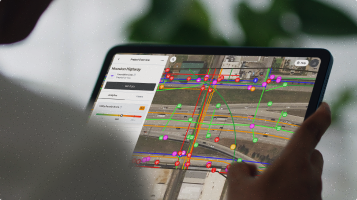
Now, LTRA uses 4M’s Foundation Utility Data to access instant, detailed utility information. “On every single job, we go to 4M as soon as we get project limits,” Murphy says. “It’s just part of our terminology now: ‘Did you do 4M on this job yet?’ It’s almost step one.” Engineers can immediately visualize specific utility lines and access lists of utility owners involved in the selected project area. 4M collects and sorts the data from existing public records and synthesizes it into a comprehensive utility map using the power of AI.
While LTRA engineers still send requests for traditional records to verify information, pulling in 4M data is part of the simultaneous process when they are scoping a project. “The Foundation Utility Data (previously real-time data) gives you that list of all the owners, so we know we’re not missing somebody,” Murphy explains. “It’s a quick snapshot of what is there, including surface objects such as manholes.”
Gathering the same preliminary utility data via Google Earth or sending someone to the field could take a full day — or longer. With 4M, it takes only a few minutes, empowering LTRA to take the lead in route planning and infrastructure development with clients like TxDOT.
On the U.S. Highway 83 project, LTRA was able to pull up 4M data and use it to show which side of the highway to widen, where it was best to take it off route, and which lines TxDOT would be responsible to move at its own cost. “When utilities are in private easements, it costs TxDOT a lot of money to help relocate them, impacting time and budget,” says Murphy. “4M's Foundation Utility data helps during pre-planning to avoid those private easements.”
While LTRA still goes into the field to verify that all utility lines have been captured in the map, the preliminary utility data gives them a head start. “We have 75–85% of the information already,” says Murphy. “There’s a significant time-saving benefit leading into it — and a better starting point for making good decisions at the outset.”
Looking Ahead
As LTRA continues to utilize 4M's Foundation Utility Data, the team sees ample benefits, such as efficiency and time savings. Having instant access to reliable utility data also gives LTRA an edge over competitors and inspires client confidence. “There’s nothing more fun than going to a kickoff meeting and pulling up the area in 4M,” says Murphy. “I say, ‘Here’s the utility data and what we’re going to be looking at.’ It inspires confidence that we know what we’re doing.”
Murphy looks forward to future innovations and add-ons from 4M. “We can tell you guys are listening to our concerns and needs,” he says. “Little things like adding manholes and telephone poles to the Foundation Utility map have made a huge difference in providing value to us. As you add more features, it’s going to become more and more valuable.”
Murphy says to DOTs, municipalities, engineering firms, and service providers interested in exploring 4M, “Give it a shot. Once you actually use it, you can validate 4M data with your own data to give you the comfort level you need. It’s an easy sell once you see it."
Straight from the source
What were the main challenges you faced with utilities on projects before 4M?
Joesph Murphy: "So a couple of the challenges are just finding good record data. We know it may or may not be out there, but actually being able to obtain it. Then even pricing projects, when we get a fee proposal request, how much is it going to cost to do this? then normally we'd have to go out in the field and kind of look around or look on Google Earth. And now 4M's kind of provided us an avenue to look at it in real time really quick and say, 'Ok here's a pretty good idea.' And I can put together a better fee proposal now."
Did you have doubts? Why did you choose 4M?
Joesph Murphy: "For sure. I had lots of doubts just because how accurate it? Were's all the information coming from? Is it really reliable? Are you going to miss something? So yeah, there's definitely a lot of things that we had to look into or double check before you get a little bit of a comfort level on the data that you're receiving. But yeah, it's been surprising. We did a few comparisons here and there along the way. We compared traditional record research versus what we found versus what you guys provided. It's been accurate so far. That's why I felt, you know, we could keep using you guys because it's definitely going to be reliable data that we can move forward with."
Does 4M give LTRA a competitive advantage?
Joesph Murphy: "Yes. There's nothing more fun than going to a kickoff meeting or you're doing a scoping meeting with someone and they pull up the area and I can pull up the area and I drop a 4M image right there in real time while they're watching and I'm doing it for them and they're "Bam! Here's the utility data and this is what we're going to be looking at." We had an owner not too long ago just actually look at their civil engineer who was doing some other stuff for them and they're like, 'Do you guys use that?' So it gave them a little bit more confidence that we know what we're doing and we're gonna give them a good product at the end of the day."
How does LTRA use 4M's Utility AI Mapping in your daily workflow?
Joesph Murphy: "So we did subscribe to 4M's Foundation Utility Data with On-Surface Object Detection. So every single job before we start, we use 4M. So it's the first thing we do. Once we know our project limits, we utilize 4M's instant utility data, whether it's just even for a cost estimate or if we already have a job. Yeah, it's just part of our terminology now. 'Did you do 4M on this job yet?' Or, 'Hey, go ahead and do 4M right when you start.' So it's step one. We still request the records, but 4M is simultaneously done for everything we do now.
What would you tell other SUE firms, DOTs, municipalities, general contractors or civil engineers interested in exploring 4M?
Joesph Murphy: "Give it a shot. You're not going to know until you try it. Once you have tried it, you'll see the difference right away. It's an easy sell at that point."
Recent blog posts

Our Newsletter
Join 7k infrastructure professionals
Get monthly insights on ways to build smarter, faster and safer with Utility AI.


