How to Locate Underground Utilities
Written by

Published on
December 28, 2021


Table of contents
Locating underground utilities is a crucial part of almost any process involving construction, engineering, design, surveying, modernization, improvement and maintenance, regional safety measures, infrastructure management, infrastructure decommissioning and material reclamation, and resilience planning.
Alongside locating, utility mapping is a crucial tool to optimize and preload the process with as much early comprehensive data gathering and mapping as possible.
But what is the actual process to locate underground utilities? What are the different options and methods, and what are the benefits, timeframe, and cost to locate underground utilities using each tool or approach? And how does utility mapping work alongside them?
Keep reading to find out:
- Why it's necessary to locate underground utilities
- Utility locating versus utility designating
- The four kinds of utility locating and designating methods
- How utility mapping compares to utility locating and designating methods
- Subsurface Utility Locating in summary
Why it's necessary to locate underground utilities
Underground utilities are present almost everywhere, from the most dense urban environment to the most rural fields, and it is not always obvious to the human eye where they can be found, or whether changes have occurred underground to a familiar site.
Locating is necessary at multiple stages in any large development or infrastructure project, especially when it spans years from initial planning to completion of construction. The cost of not locating underground utilities can be catastrophic, especially if it involves large networks, explosion-prone materials, or critical utilities for modern life such as water or electricity.
Utility locating versus utility designating
According to the ASCE 38-02, the strict definition of locating is:
the process of exposing and recording the precise vertical and horizontal location of a utility.
However, many contractors use the term locating to refer to the activity of designating, which is defined as:
the process of using a surface geophysical method or methods to interpret the presence of a subsurface utility and to mark its approximate horizontal position (its designation) on the ground surface.
Locating underground utilities thus includes two approaches. The first, strict definition of locating is to physically confirm the position of a utility by removing the ground cover, paving, or other materials above it. While this approach has 100% accuracy, it has many limitations on use. It is expensive and time-consuming, and it requires site access and permission to break ground, which are not always available throughout a project lifespan. It may not even be possible to reach all utilities if they are highly layered and interconnected in a specific place. Finally, it comes with a degree of risk, as any act of excavation can cause damage to an underlying utility if not conducted properly.
The second, broader definition of locating through designation means to infer the position of a utility underground by using a combination of diagnostic tools, documents, coordination with multiple individuals and organizations, personal experience, and educated reasoning. This approach spans a variety of methods and tools, and the accuracy is highly variable. Some tools and documents can be trusted, but many give incorrect or incomplete data about underground utility locations. In general, this broader approach to locating relies on informed and diligent interpretation by an experienced professional.
The four kinds of utility locating and designating methods
The ASCE 38-02 categorizes this broader approach to utility locating and designating through four quality levels.
Utility quality level D refers to:
information derived from existing records or oral recollections.
This category includes as-built drawings collected from government archives, private land owners, utility owners, or designers; information in the public domain, such as pipeline location; and verbal information from people who were involved in the design, installation, or maintenance of the underground utilities. These sources of location information cannot be treated as absolute fact, as people’s memories are not perfect, and as-builts do not always show every change that was made to the design during the installation on site. They may be cheap, but they are not always quickly accessible or available in a digital format, especially if the utilities are old and the site or utilities have changed ownership several times.
Utility quality level C refers to:
information obtained by surveying and plotting visible above-ground utility features and by using professional judgment in correlating this information to utility records.
This means looking for the above-ground evidence of utilities below the surface, such as manhole covers, control boxes, meters, air vents, connections to utility poles or utility stations, and other signs like changes in grass or agricultural crops. These signs only show specific points in the underground network, however, and must be analyzed in combination with additional sources of information to confirm the location of underground utilities.
Utility quality level B refers to:
information obtained through the application of appropriate surface geophysical methods to determine the existence and approximate horizontal position of subsurface utilities.
This category includes the majority of sensing devices and tools used for underground utility locating, including ground penetrating radar (GPR), frequency locators, electromagnetic conductivity, magnetometers, and cable locators. These tools must be used by an experienced technician, due to the complexity of interpreting their readings and knowing which tool to use, to look for which kinds of utilities, at which depth, in which kind of soil or ground.
For example, GPR uses radar pulses in the microwave frequency band to detect reflected signals from underground structures or objects. Most importantly, GPR can detect utilities that are not made from metallic elements. However, the value of GPR results depends on the correct use of the tool and the ground conditions. In sandy or mixed soils, the ground is resistive rather than conductive, so the readings are more reliable. In moist or clay soils, however, the ground is more conductive, so the radar pulse cannot penetrate deeply. Lower frequencies can penetrate better than higher frequencies, but they give less detailed readings.
Tools like electromagnetic conductivity instruments and magnetometers are able to penetrate the ground deeply to detect metal utilities, conductive pipes, and electric cables. Electric, phone, and fiber optic lines can also be located by frequency locators, and cable locators use a variety of methods to detect cables below ground.
In general, these are all very important tools to locate underground utilities, but can be expensive to use on a very large site, and the results are only as good as the operator using the device. Furthermore, they require some advance knowledge of what utilities the operator should expect to find underground. Without this information, it is difficult to use the tools efficiently and precisely for the right kinds of designation. If there are abandoned utilities or significant differences between as-builts and the real underground utility position, it can be expensive or risky to rely completely on these tools to verify locations.
Finally, utility quality level A refers to the strict definition of locating:
precise horizontal and vertical location of utilities obtained by the exposure and subsequent measurement of subsurface utilities.
But the previous quality levels are necessary to know where and how to expose, using which materials, from large excavators to small hand digging tools, in order to ensure safety. This technique must also be used efficiently to avoid delaying construction progress.
How does utility mapping compare to utility locating and designating methods?
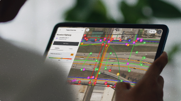
Finally, utility mapping is another method alongside these approaches, which can provide remotely gathered information based on satellite imagery and computer algorithms. The main benefit of utility mapping is that it is cost-effective, requires no physical access to the site, and can be done quickly over very large geographical areas. In combination with other methods to locate underground utilities, utility mapping can be a valuable tool to reduce costs, conduct due diligence, and gather comprehensive data to improve the design and construction process over the whole project lifespan.
Subsurface Utility Locating
In conclusion, Subsurface utility locating is a process used to identify and map the location of underground utilities. It is a vital part of any construction project, as it helps to ensure the safety of workers, prevents costly damage to underground utilities, and helps to reduce the environmental impacts of the project. Subsurface utility locating involves a variety of methods, including ground-penetrating radar, magnetic field sensing, and vacuum excavation. These methods allow for the detection of underground utility lines and other buried objects, such as pipes, cables, and drainage systems. The results of these methods can then be used to create an accurate map of the underground utilities, which is essential for any construction project.
Recent blog posts

Our Newsletter
Join 7k infrastructure professionals
Get monthly insights on ways to build smarter, faster and safer with Utility AI.

.avif)


