Climate change & 4M
Written by

Published on
February 25, 2021


Table of contents
The climate is changing, and in the past year we have felt its wrath in the form of natural disasters.
In California we have witnessed terrible wildfires, burning through the state for months on end, creating over $12 billion in damages, and disconnecting hundreds of thousands of citizens from their most basic utilities.
2020’s Atlantic Hurricane season named 30 storms, causing $37billion in damages, mainly to infrastructure. And just last week an immense snowstorm hit Texas, leaving over 4 million citizens without electricity.
This new era is coercing humanity to take action and protect the most crucial infrastructures of our everyday lives.
In order to cope with these natural disasters, a growing number of businesses and local authorities have suggested and decided to bury their utilities.
This was found to be an ideal solution that is able to protect such essentials during extreme climate events such as wildfires, tornados, floods, and others. Unfortunately, most utility owners / stakeholders have yet to bury their assets, as it is significantly more expensive than leaving them above ground.
According to a study conducted by PG&E, one of the largest utility companies in the US, above ground costs of setting up utility infrastructure are estimated at $10 per foot. On the other hand, underground costs, burying the infrastructure, may cost $20-40 per foot – up to four times more than above ground costs.
One of the most significant hurdles, from both a time and cost perspective, are the SUE activities - mapping the subsurface in order to make sure that there aren’t any utilities that could be damaged in the excavation process.
This assignment is extremely demanding, as it relies on old and inaccurate blueprints, field investigations, geophysical locating, and utility exposing. This is a set of procedures that is easily affected by both human error and nature’s characteristics (weather, terrain, etc.), making this process difficult to predict in regard to time, cost, and overall success.
In other words, it is very difficult for utility owners to commit to plans of utility burying, when any small mistake or unplanned event can damage their supply to millions of Americans.
This is precisely where 4M provides solutions, as it makes manual records - redundant, field investigations – automated, geophysical locating – scalable, and the need for utility exposing – minimized.
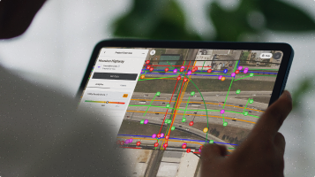
Its combination of remote sensing, AI, and computer vision generates a mapping simulation engine that gives utility owners and stakeholders an accurate & up-to-date description of the subsurface terrain. It’s a comprehensive, detailed utility map of the known and unknown utilities in the subsurface, thus preventing unexpected costs, budget overruns, infrastructure damages and schedule delays in such projects.
If there is a key to unearthing critical utilities – it is probably 4M, as the company makes sense of what has become a complex environment that conceals countless miles of man-made infrastructure. The company makes sense of the underearth.
Recent blog posts

Our Newsletter
Join 7k infrastructure professionals
Get monthly insights on ways to build smarter, faster and safer with Utility AI.

.avif)


